State Park · Utah
Goosenecks State Park
- Location
- San Juan County, Utah
- Nearest town
- 39.6 miles southwest of Blanding
- Type
- State Park
About Goosenecks State Park
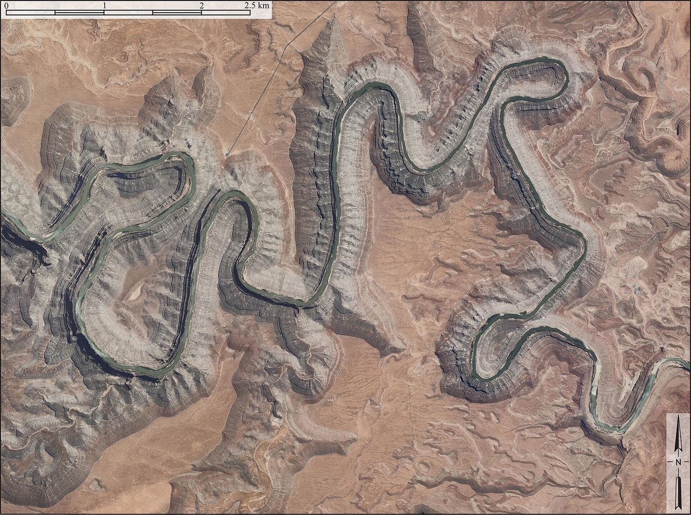
Millions of years of erosion by water, wind, frost, and gravity carved the incised meanders visible from the overlook here, as the Monument Upwarp pushed the San Juan River to cut downward while the surrounding land rose. The result is a gooseneck-shaped bend more than 1,000 feet deep, cited as a textbook example of this river formation. The park offers a viewpoint over this canyon feature rather than access to the river itself.
Hours, fees, camping, reservations and closures are set by the park and change often. Check the official park site before you go.
Getting there
Goosenecks State Park is in San Juan County, Utah, 39.6 miles southwest of Blanding. The Directions button takes you to the park's mapped location; the entrance may be elsewhere, so check the official site for the address to use.
State parks near Goosenecks State Park
Within 60 miles, closest first, straight-line. All 46 in Utah →
Facts from Wikidata, checked September 25, 2026. Distances are straight-line.