State Park · South Dakota
Palisades State Park
- Location
- Minnehaha County, South Dakota
- Nearest town
- 2.2 miles southwest of Garretson
- Type
- State Park
About Palisades State Park
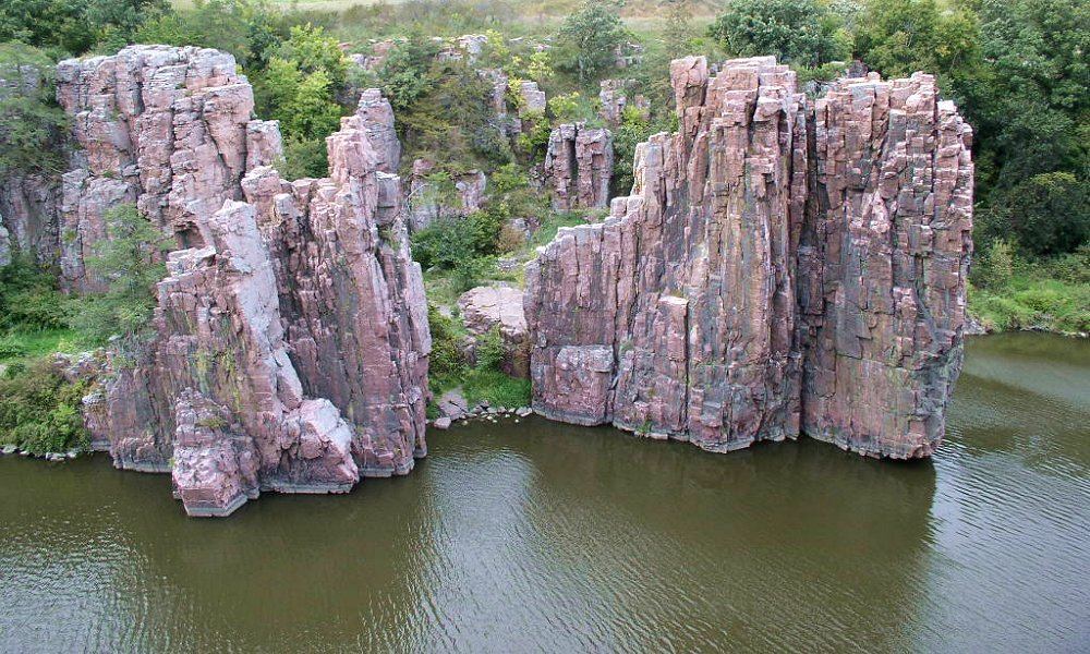
At 435 acres, this is South Dakota's second-smallest state park, built around pink Sioux Quartzite cliffs and rock formations carved out by erosion. The land sits a short drive off Interstate 90, with the exposed quartzite forming the walls and outcrops that define the site. Its small footprint concentrates the rock scenery into a compact area rather than spreading it across a larger landscape.
Hours, fees, camping, reservations and closures are set by the park and change often. Check the official park site before you go.
Getting there
Palisades State Park is in Minnehaha County, South Dakota, 2.2 miles southwest of Garretson. The Directions button takes you to the park's mapped location; the entrance may be elsewhere, so check the official site for the address to use.
State parks near Palisades State Park
Within 60 miles, closest first, straight-line. All 12 in South Dakota →
- Good Earth State ParkState Park · Lincoln County, SD15 miS
 Split Rock Creek State ParkState Park · Pipestone County, MN16 miNE
- Blue Mounds State ParkState Park · Rock County, MN17 miE
- Newton Hills State ParkState Park · Lincoln County, SD32 miS
 Lake Herman State ParkState Park · Lake County, SD38 miNW
 Lake Shetek State ParkState Park · Murray County, MN50 miNE
- Union Grove State ParkState Park · Union County, SD55 miS
 Camden State ParkState Park · Lyon County, MN55 miNE
 Oakwood Lakes State ParkState Park · Brookings County, SD57 miNW
Towns near Palisades State Park
State parks near Sioux Falls, State parks near Brookings, State parks near Worthington
Facts from Wikidata, checked September 25, 2026. Distances are straight-line.